


The Erie Canal
The Canal that cemented New York’s Economy
The Erie Canal is an amazing story that has been effectively lost with changes to US History requirements in education. In the “olden days” Americans used to learn a lot more history that was interesting and not facts learned by rote only for tests. This is one of the great stories that got lost, but can still give us an important lesson on how geography effects economic growth.
What is the Erie Canal
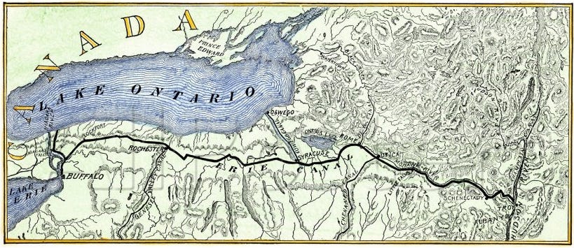
The Erie Canal connected the Hudson River at Albany, New York to Lake Erie at Buffalo, New York. Built and rebuilt, it allowed goods and freight to be shipped on water to get from the Midwest to the Atlantic trade routes, via New York City.
It was completed and opened in 1825, it was the first navigable water way to allow access from the Atlantic Ocean to the Great Lakes. It coincided with improved trade relations with England which allowed midwestern wheat to be exported at a profit. It was also the biggest, longest and most profitable of the canal infrastructure in the United States. When completed it was the second longest canal, after the Grand Canal in China.
Why is it in New York?
The location of the Erie Canal is a result of geography. The Appalachia Mountains run north to south from Georgia all the way up to Maine. Along this mountain chain there is only one large valley / mountain gap area. This gap is through the Appalachian Mountains in central New York, allowing the Erie Canal to be built. The only other navigable option from the American Midwest was down the Mississippi River to New Orleans, and then out to Europe. This was far too long for foodstuff shipments before refrigeration and more modern preservation techniques.
The canal route was not easy to build. The elevation rise is about 566 feet, including steep rises at both ends of the canal. The canal originally had 50 locks and has been expanded and renovated a few times, always to expand the width and depth of the canal, and to reduce the overall length and to reduce the number of locks necessary.
Economic Impact
When completed in 1825, there was no railway system in the United States. Nearly all traffic in goods occurred via canal or horse carriage. The canal system was much quicker and cheaper. The speed can be seen in the early transportation of people, who happily moved from Horse Coach to Boat Trips. In 1825 more than 40,000 passengers used the canal.
The canal causes transportation costs dropped along the route. For example, before the canal was built, a barrel of flour cost $3 to ship from Rochester to Albany. After the canal, that price dropped to 75¢. So the cost of goods dropped dramatically enabling both more consumption and
The Erie Canal opened traffic from the Great Lakes and their ports for national and international trade. The peak year of traffic was 1855 when 33,000 commercial shipments took place – and the canal is closed in the winter months. It also opened the Midwest for settling by Eastern immigrants, contributing to a boom in the Great Lake ports like Detroit, Toledo, Duluth, and Chicago. Chicago was founded in 1837 with about 4,500 people. By 1880 500,000 people lived there and by 1900 over 1 ½ million people.
The Erie Canal drove the primacy of New York City as export center of the nation. It eclipsed Philadelphia and Baltimore who could not compete on price. Furthermore, it cemented New York as the primary destination for immigrants. The process of getting to the Midwest and settling there became much easier with the cheap travel costs of canal trade.
At the eastern terminus, Albany became a major city. From 18109 to 1850 it was one of the top 10 most populous cities in America.
At the western terminus, the city of Buffalo was founded and grew at an amazing rate. The population stood at about 2,000 when the canal starting excavation, to 40,000 by 1850 and growing to 580,000 in 1950. It was one of the top 10 most populous cities in America during the 1800s and still the 17th largest city in American in 1950. With the irrelevance of the canal, the population has declined since the 1960s. Buffalo currently ranks as the 80th largest city in America, and its population is declining by a rate of .5% to 1.5% per year.
Decline of Economic Variability of the Canal
Railway Competition
Early construction of rail lines began in 1830 and were competitive in most of the nation starting around 1860. But the canal was commercially competitive for nearly a hundred years until 1902. Passengers switched to the railroad starting in the 1850s, when a rail line followed the same general route as the Erie Canal.
But despite the railway competition, moving bulk items was still much cheaper along the canal. Peak traffic hit in 1951 when 5.2 million tons of freight were transported via the canal.
The Saint Lawrence Seaway
The event that really ended the reign of the Erie Canal occurred in 1959 (a year that was surprisingly important) when the Saint Lawrence Seaway was opened. The Seaway system uses or parallels the Saint Lawrence River from the Great Lakes to the Atlantic Ocean allows for much larger ships and containers to be transported between the American Midwest and the Atlantic. The Erie Canal, despite being expanded and deepened cannot compete with the shipping capabilities of the Saint Lawrence Seaway.
Today
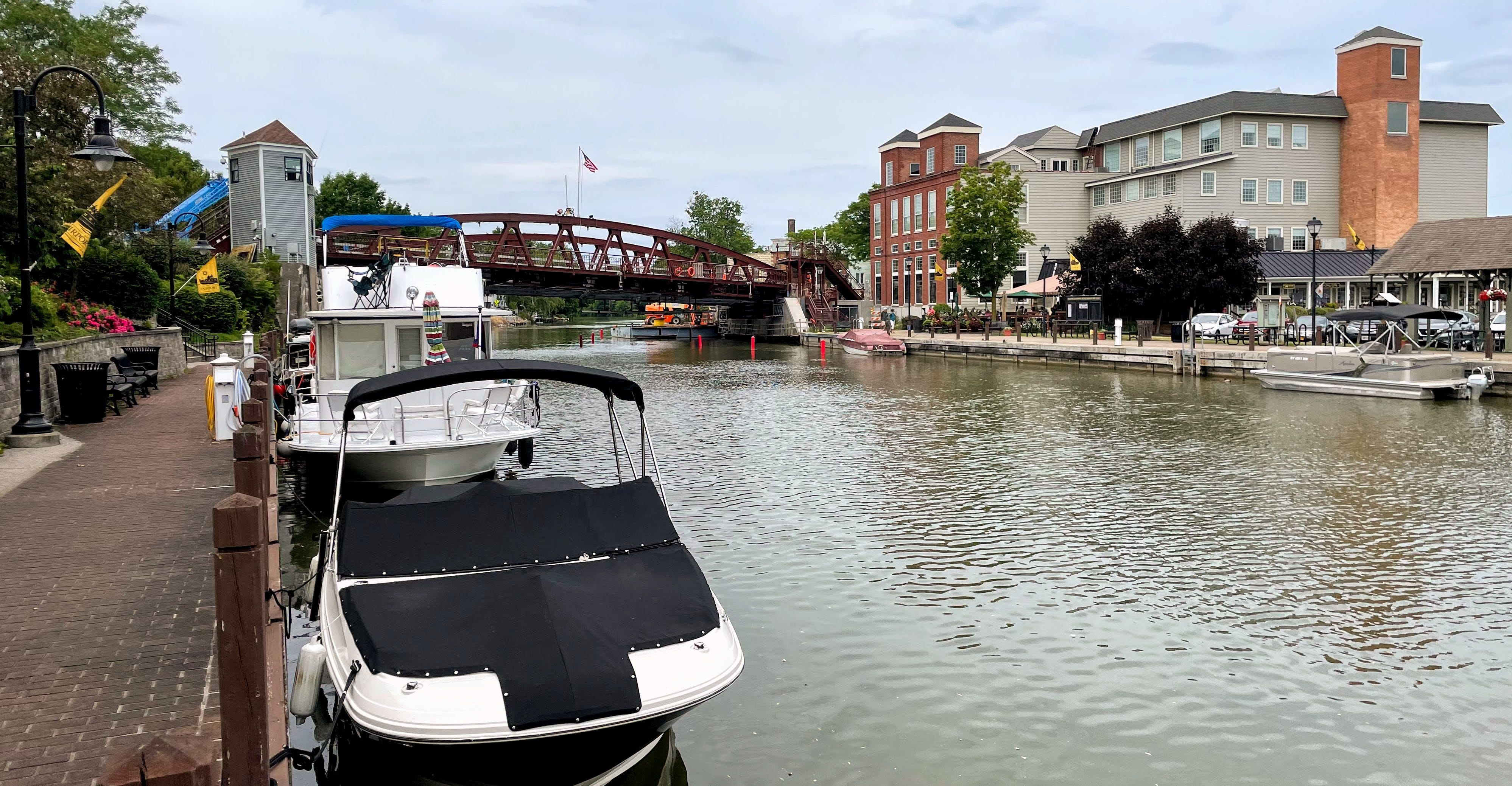
The Erie Canal is now used by pleasure craft and local cities. From Spring to Autumn private boats, party barges, and dinner cruises use the waterway. Many cities have focused redevelopment on the canal’s path through cities.
In parts of the states, the very old towpaths are used as hiking trails or bike paths.
State and city parks use either the new or old canal routes for celebrations and holidays.
In short, the Erie Canal has been gentrified in New York State.